OPTIMAL RANGING ORION TRACKING SYSTEM
- ROV, Vessel Fixed or Towed Wing or Sled
- Number of sensors: 2, 4, or 6 at arbitrary orientation and relative positions
- AC Magnetic Field Sensitivity( Noise Floor): 1 mA/ m @100 Hz
- Operating frequencies (Hz) : 10 to 1600 Hz, in steps of 1 Hz
- Simultanious Frequencies: 1, 2, or 3 (Any combination of passive/active tones)
- Minimum detectable AC magnetic field strength for target positioning: 10 mA/ m @ 100 Hz
- Maximum radial distance to utility: 10, (1.5 m sensor spacing)
- Depth accuracy: 0.05m + 5% of radial distance to target
- Offset accuracy: 0.05 + 5% of radial distance to target
- Cable position output 10 Hz
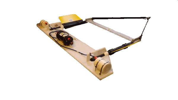
ORION is Optimal Ranging Inc. new flagship product for Underwater Utility Surveying. Extending LIBRA's Fieldsens technology, ORION now includes MultiSens and is available in two, four or six sensor configurations. ORION is rated to a depth of 2000 m and is therefore ideal for use in deep-sea surveys with ROV's. It may also be mounted on other platforms such as a sled or a wing. ORION is integrated with leading hydrographic survey software including EIVA, QINSY and HYPACK.
The ORION system can be ROV mounted or deployed in a towed of fixed-hull set up. For deeper cable and pipeline mapping projects in larger bays or on the continental shelf, the system can be towed over or positioned above the seabed by depressor or mounted on a carbon fiber sled, respectively. On a vessel with a non-ferrous hull, the fixed set up can be used in waters only a few meters deep enhancing accuracy since the positioning error of the ORION sensor frame relative to the vessel is minimized. In combination with bathymetric seabed data obtained from a terrain model, ORION altimeter, or vessel depth sounder, the difference between bottom and utility depth can provide depth of cover accompanied by a 95% confidence interval.
The ORION system features a narrow band filtering engine that provides quadrature demodulated magnetic field strengths and in this way possible magnetic noise sources are eliminated. ORION can perform three simultaneous Depth of Burial (DoB) detection. This permits tracking a 50Hz tone at the same time as an actively applied tone on a targeted power cable or one survey can capture up to three targeted cables or pipelines in one pass.
The ORION underwater Utility system brings the power of Model Based processing to cable and pipeline DoB surveys. The method is based on the optimization of data from multiple sensors against a model of the magnetic field expected from a utility line carrying an AC tone (actively applied or passively present). System accuracy is estimated and presented in real-time.
Magnetic field distortion due to co-linear underwater conductors can occur when multiple pipelines share a right of way, or multiple wind farm power cables are closely placed at a landfall. The ORION system self identifies these errors and presents them as confidence intervals on the measured DoB. In the four or 6 sensor configuration, Orion can de-couple this distortion from the target pipeline or cable, resulting in a more accurate DoB estimate, with an improved confidence interval.
The ORION sensor array only needs to be brought in the approximate vicinity of the utility line to calculate a relative position. Using at least two 3-D magnetic field sensors, a triaxal accelerometer and digital compass, ORION continuously identifies the horizontal offset, vertical depth, tone current strength and yaw angle to the buried utility regardless of its position and relative orientation in the radiated magnetic field. ORION can be controlled and interrogated using standardized NMEA commands over a serial data link using RS485/RS232 protocol. System control and data acquisition over an ROV's local area network is also supported.
Oceanscan can also provide the following to complement the equipment-
ORION X-WING TOW FRAME
GEOMATRIX TVG GRADIOMETER FRAME
ALTIMETER
GEOMETRICS MAGNETOMETER
GEOMATRIX TELEMETRY POWER
LOC 150TX TONE GENERATOR
Please contact the rental team for more information at rental@oceanscan.co.uk.
Download files